Десять дней севера. День 7.
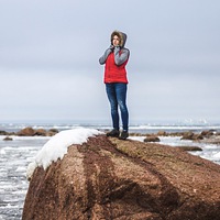
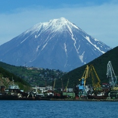
День седьмой. Дорога в Норвегию. Встали в 7 утра, в 8 сдали квартиру, залили бензина полный бак и 40л в канистры. Ехали мы одной машиной, на дискавери. Путь лежал к МКПП Лотта, что в 250км от Мурманска. С утра был туман, местами весьма густой. Дорога средней паршивости, но Антон летел бодро. Перед самой границей есть заправка с соляркой по 42р. Это в 2 раза дешевле, чем в финке, так что заправляем полный бак и едем на границу. Наших проходим быстро, а вот фины нашли на колесе грыжу и заставили менять. Грыжу скорее всего заработали с утра на плохой дороге. Опять танцы с запаской, ставим колесо и мчим вперёд. Спокойная езда по дорогам Лапландии и через километров 200 мы пересекаем границу с Норвегией, которая проходит по реке (граница). Навигатор уверенно ведёт нас на север и вот на горизонте появляются горы. Остановка на фотографии, мчим дальше, стараясь фотографировать из окна. И вот километров за 150 до цели мы выезжаем на берег моря и едем вдоль красивого фьорда. Немного жаль, что сейчас отлив, но зрелище всё равно впечатляющее. Меняемся с Антоном, я сажусь за руль. Появляются тоннели. Никогда не ездил по таким длинным тоннелям, норвеги круты, что так грызут свои горы. Природа начинает напоминать п-ов Рыбачий, посещённый нами пару дней назад. Только тут кто-то проложил дорогу и построил дома. Ещё немного и въезжаем в округ Нордкап, меняемся с Антоном обратно. Едем, смотрим по сторонам, тут крик "олени!" Мы с Лёшей хватаем фотоаппараты и бегом снимать здешних обитателей. Но олени те ещё тролли и как только подойдёшь к ним чуть ближе, сразу быстро сваливают. Немного накрапывает дождь, едем дальше. Вот и тоннель на остров, где находится самый северный мыс Европы. Идёт он под водой целых 6,5км. Примерно в середине тормозим в кармане и делаем фото на память. Тоннель пройдем и мы совсем близко к цели, пора искать ночлег. Мы уже на 2° севернее мыса Немецкого и тут погода ещё суровее, но мы ещё не представляем, что ждёт нас дальше. Доезжаем до города Хонигсвог, понимаем, что Норвегия страна цивилизованная и просто так свернуть с дороги и поставить палатку не получится. Находим дорогу в горы, едем по ней, поднимаемся довольно высоко, обнаруживаем, что это дорога к военной базе и дальше ехать нельзя. На улице довольно сильный ветер, тут спать будет плохо. Спускаемся немного ниже, там мы приметили неплохое место для стоянки. Вышли, вроде ветер потише, разбиваем лагерь. Быстро перекусили и пошли спать и как раз начался дождик. Ночёвку я опишу отдельной заметкой.
Часть 1 - http://vk.com/wall1494_12150
Часть 2 - http://vk.com/wall1494_12263
Часть 3 - http://vk.com/wall1494_12466
Часть 4 - http://vk.com/wall1494_12486
#посеверномупути
Ten days of the north. Day 7
Seventh day. Road to Norway. We got up at 7 am, at 8 rented an apartment, poured gasoline full tank and 40 liters in canisters. We drove the same car in the discovery. The path lay to the manual transmission Lotta, which is 250km from Murmansk. In the morning there was fog, in places quite thick. The road is average lousy, but Anton flew boldly. Before the very border there is a gas station with diesel fuel at 42p. This is 2 times cheaper than in Finn, so we fill a full tank and drive to the border. We pass quickly, but the Finns have found a hernia on the wheel and are forced to change it. Hernia most likely earned in the morning on a bad road. Again, dancing with a spare wheel, put the wheel and rushing forward. A quiet ride along the roads of Lapland and after 200 kilometers we cross the border with Norway, which runs along the river (the border). Navigator confidently leads us to the north and mountains appear on the horizon. Stop on the photo, rushing on, trying to take pictures from the window. And for about 150 kilometers to the target we go to the seashore and drive along the beautiful fjord. It is a pity that the tide is now, but the spectacle is still impressive. We are changing with Anton, I get behind the wheel. Appear tunnels. I have never traveled through such long tunnels, the Norwegans are steep, they gnaw their mountains in such a way. Nature begins to resemble the Rybachy Peninsula, which we visited a couple of days ago. Only then someone paved the way and built houses. A little more and we drive into the North Cape district, we change back with Anton. We're going, looking around, here the cry "deer!" Lesha and I grab cameras and run to shoot the local inhabitants. But the deer are still trolls, and as soon as you approach them a little closer, they immediately quickly dump them. It is raining a little, going further. Here is the tunnel to the island where the northernmost cape of Europe is located. He goes under the water as much as 6.5 km. Around the middle we slow down in our pocket and take a photo for memory. We will go through the tunnel and we are very close to the goal, it's time to look for an overnight stay. We are already 2 ° north of Cape German, and then the weather is even more severe, but we still have no idea what awaits us further. We reach the city of Honigsvog, we understand that Norway is a civilized country and it’s impossible to just turn off the road and put up a tent. We find the road to the mountains, drive along it, climb quite high, we find that this is the road to the military base and it is impossible to go further. The wind is quite strong outside, it will be bad to sleep here. We go down a little lower, there we noticed a good place for parking. They came out, like the wind is quieter, we set up camp. We had a quick snack and went to bed, and it was just starting to rain. Overnight, I will describe a separate note.
Part 1 - http://vk.com/wall1494_12150
Part 2 - http://vk.com/wall1494_12263
Part 3 - http://vk.com/wall1494_12466
Part 4 - http://vk.com/wall1494_12486
#newpath


У записи 7 лайков,
2 репостов.
2 репостов.
Эту запись оставил(а) на своей стене Максим Стерлядкин


